Slieau Whallian is a hill that dominates the landscape of St. John’s village in the Isle of Man, looming over it with its summit of around 1100ft high, and a thick forest of mainly Larch and Pine trees. To the west side there are some deciduous trees, but still mostly larch and pine dominated. I often walk up it for exercise and the stunning views, but the best bit about it is that once at the top, it feels a world away from anything. Great for a bit of peace and quiet.
About
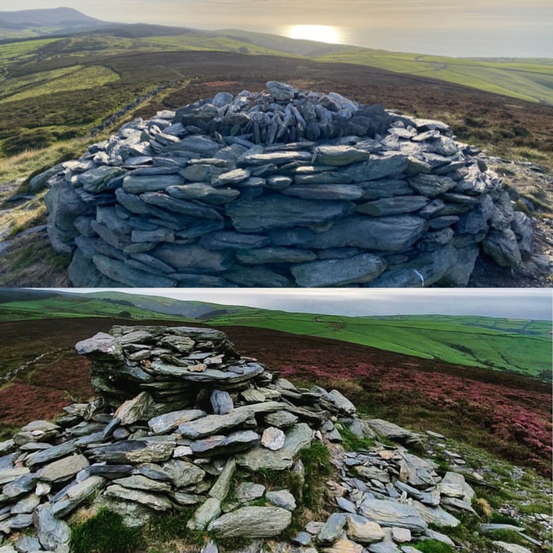
The hill is very popular with walkers, runners, and more recently (with the addition of many new routes) with mountain bikers. As a result, there are many events held annually on the hill such as fell running and time trials but despite this, you can very easily walk up it without encountering a single soul, even on a nice day. There are so many different routes to the top too, so theres always new things to see. Many people have confusion over whats considered the actual summit of Slieau Whallian, mostly due to the presence of two seperate cairns. The first being at the top of the treeline, around 900ft where the steepness and forest end, and where there is a very well made upright Cairn overlooking Peel and the West coast.
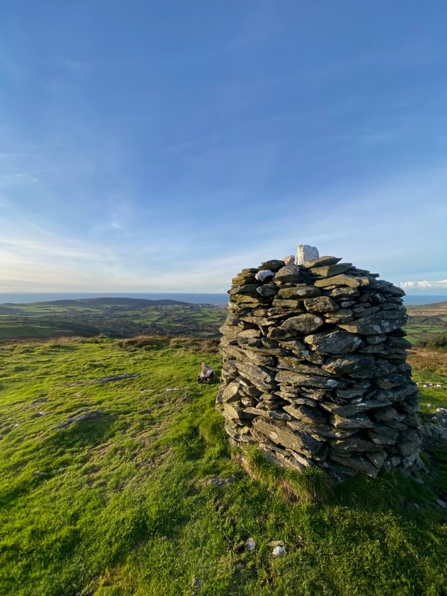
The second and “true” cairn marking the peak of the hill however, is located another kilometre or so away, over the plateau – a long flat grass and scrub area, often inhabited by cows, where you reach another short uphill of around 200ft to climb before you reach swathes of heather and a larger, more erratic (for lack of a better word) cairn that has beautiful 360 degree views of South Barrule, Peel, Greeba valley and even the very top of Snaefell to name just a few. [Since the publication of this article, said erratic cairn has been replaced by three local lads of the Village with a rounded quartz topped cairn, with indications of North, South, East, and West. Shown below]
History
Growing up St. John’s, Slieau Whallian has always been known to me as “The Witches Hill”, not a light hearted children tale if you can believe it however. Apparently an unfortunate woman accused of witchcraft would be “put into a barrel with sharp iron spikes inserted round the interior, pointing inwards, and thus, by the weight of herself and the apparatus, allowed to roll from the top of the hill to the bottom.” Not a very thought through method if you ask me.
Jenkinsons’s Practical Guide to the Isle of Man (1874), the source of this information, also relates the following account:
“It is said that a man who was accused of murder and condemned to suffer death on this hill pleaded his innocence of the crime laid to his charge, and told his accusers that if he was not guilty, a thorn-tree would grow at his head where he was buried, and that a well or spring of water would lie found at his feet (I have yet to locate either of these). And, moreover, he warned his persecutors that as sure as he suffered wrongfully, he would continue to frequent and trouble the locality so long as grass continued to grow, or water to flow; and being faithful to his word, he continued to annoy and terrify the neighbourhood in succeeding ages.” (Again no sign of him recently, but you never know).
Exact Location
Travelling into St. John’s on the A1 from Douglas to Peel, turn left opposite Tynwald Hill, then first right onto the Patrick Road (A30). Immediately after the junction over a small humpback bridge, there is a left turning known locally as the Gleneedle Road. Access to the main entrance of the plantation is a short distance along this ascending road on the right and has ample parking next to the entrance. There are numerous entrances on the Patrick road that are easily spotted driving past, and even a Greenway road that is on the right if you head up the Gleneedle road further past the main entrance.
